- Role
- GIS Web Developer & Frontend Engineer
- Year
- 2026
About this project
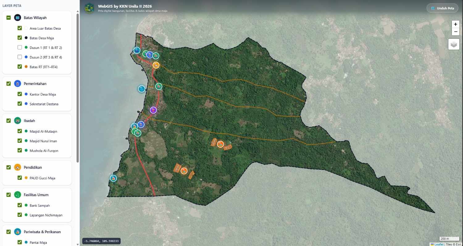
An interactive, mobile-first WebGIS platform for digital spatial mapping of Maja Village. Built on top of geospatial shapefile data converted into GeoJSON, it accurately renders administrative boundaries (village, sub-villages/dusun, and RT divisions) alongside vital local infrastructure including government offices, places of worship, educational facilities, public amenities, and tourism spots. Features dynamic layer filtering, satellite basemap toggling, responsive mobile bottom-sheets, and photo-enabled location popups.
The WebGIS Digital Map of Maja Village is an interactive, mobile-first geographic information platform engineered to deliver accurate geospatial visualization for the local government and community of Desa Maja, Kalianda, South Lampung. Developed to modernize village spatial management, the application translates raw spatial shapefile (SHP) datasets into lightweight GeoJSON layers, enabling seamless in-browser mapping without relying on heavy desktop GIS software.
The platform accurately renders administrative borders down to village, dusun, and RT sub-divisions, paired with automated polygon calculation via Python to ensure boundary precision. Key community assets—including public infrastructure, governmental offices, educational hubs, religious centers, and ecotourism sites—are organized into dynamic, filterable layers. Designed with field usability in mind, the interface features satellite imagery basemaps, responsive mobile bottom-sheets, coordinate indicators, and dynamic popups that automatically render on-site verification photographs alongside critical point-of-interest details.
Key features
- Multi-Tier Administrative Boundary Mapping (Village, Dusun, and RT Levels)
- Dynamic Category Layer Filtering (Government, Worship, Education, Public, Tourism)
- Geospatial Data Pipeline from ESRI Shapefile (SHP) to Optimized GeoJSON
- Automated Dusun Sub-Division Polygon Clipping via Python Shapely
- Interactive Photo-Enabled Point of Interest (POI) Popups
- High-Resolution Satellite Basemap Layer Integration with Leaflet
- Mobile-First UI Featuring a Responsive Bottom-Sheet Control Drawer
- Zero-Configuration Local Media Asset Linking for Location Photographs
- Lightweight Client-Side Rendering Deployed via GitHub Pages
Tech stack
WebGIS Digital Map of Maja Village is built with Leaflet.js, GeoJSON, JavaScript, HTML5, CSS3, Python.